Palo Pinto Mts State Park construction to start this year
 by Amy Martin
Sept. 16, 2020
Original post at https://www.greensourcedfw.org/articles/palo-pinto-mts-state-park-construction-start-year
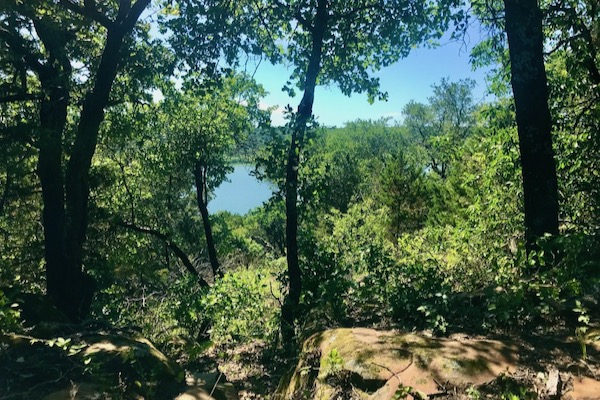
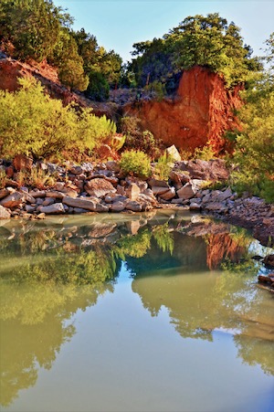
From my vantage point high on the ridge, the waters of rock-rimmed Tucker Lake are clear and still. Flameleaf sumacs along the dam hint of fall color to come. The ridge across the 90-acre lake rises sharply, its limestone layers punctuated by strips of brown sandstone. The unmistakable dark green of blackjack oak contrasts smartly with the sage of mesquite and muted grey-green of yaupon. In the low areas around the lake mouth, the emerald green of cedar elm and pecan adds a cooling touch.
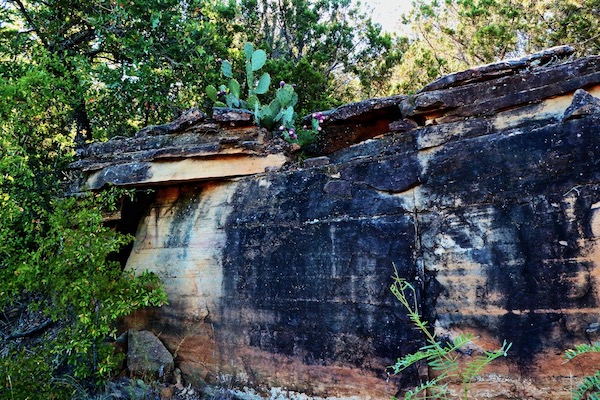
A new-to-me plant growing from the cracks of one of the many immense sandstone boulders draws me off to the side. As I step, a lizard skitters and grasshoppers flee. The relentless call of the eastern phoebe rises from the shore: FEE-bee, FEE-bee, FEE-bee!

A deep jagged ravine opens up into a steep, sheltered canyon with a creek that struggles to flow. Until thunderstorms come – then it will become a torrent. Tantalizing lush greenery fills the bottom; there could be a seep. Through the canyon maw, I can see for what seems like miles to unrolling ridges in the distance.
Welcome to the North Texas Hill Country, with tree-covered ridgelines providing beautiful vistas, creeks surging over cool limestone. The hilly, rocky terrain – the geologic, angular, west half of the Western Cross Timbers – begins around Mineral Wells and stretches west to Possum Kingdom, running north from I-20 for about 60 miles.
Driving west from Fort Worth on the interstate, about halfway to Abilene, it’s easy to overlook the optimistically named Palo Pinto “Mountains.” There reside nearly 5,000 rugged acres of timber, prairie and creeks someday to be Texas’ first new state park in 20 years: Palo Pinto Mountains State Park. Or will be once funding is complete.
MIGHTY MITE MOUNTAINS
“The formations in this area on many maps are actually referred to as Palo Pinto Mountains,” says Texas Parks and Wildlife park superintendent James Adams. “I know it doesn’t quite meet the standard for a mountain, which I believe is 2,000 feet, but we have at least one ridge that’s over 1,600 feet. It’s exceptionally rugged.”
As you drive north from the interstate, notes Adams, you get bigger and bigger ridgelines and deeper and deeper valleys.

“People just don’t realize that this exists in North Texas. It’s a sort of topography that’s usually associated with the Hill Country. When you get off the highway and start winding through, you realize what a huge area it is.”
Want to hike? Palo Pinto Mountains State Park will boast more than 20 miles of multi-use trails for hikers, mountain bikers and horseback riders. Some reach into remote areas of the park with expansive vistas.
Camp in the outback? You can do that, too, at a primitive campground. Stay overnight with the horses? A shady equestrian campground will fill that need. Fish, kayak, canoe? You’ll have 90-acre Tucker Lake for that.
Also bird watching, stargazing, and “all that you associate with the more low-key peaceful outdoors experiences,” says Adams.
“What will draw people is its intrinsic beauty,” says Adams. “Every part of Texas has a beauty to it that’s unique and belongs solely to that area. There’s no way to experience it without just going there. I expect that folks from all over Texas and the neighboring states will eventually hear about it and make their way here.”
MAKING IT HAPPEN
Voters approved Proposition 5 in 2019 to allow direct funding to state parks and historic sites through sporting goods sales tax starting in 2021. The overwhelmingly positive vote showed consensus on the need for more Texas state parks.
But Palo Pinto Mountains State Park has been in the making since 2011 when the first land was purchased.
“So Proposition 5 did not affect the development of the park at all,” says Adams.
Funding approved before the amendment was insufficient to cover all costs.
“Texas Parks and Wildlife Foundation, which is our nonprofit partner,” continues Adams, “is raising private dollars to maximize the public dollars to construct the buildings and infrastructure. TX-DOT [Texas Department of Transportation] is covering the construction of roads.”
According to the foundation, “The recent appropriation of $12.5 million by the Texas Legislature to open Palo Pinto Mountains State Park is being hailed as a major victory by conservationists, outdoorsmen and women, and all Texans who enjoy spending time outside. Texas Parks and Wildlife Foundation is committed to raising up to $9 million to amplify the funding appropriated by the Legislature.”
The group has also secured a $3 million challenge grant. Park enthusiasts are encouraged to visit the donation site. For sponsorships that include naming rights, contact the foundation.
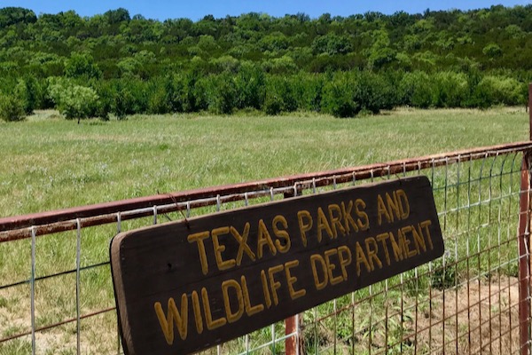
The main buildings will be limited to a 24-acre area near Tucker Lake. A full visitor center with educational exhibits and activities, trail maps and park information and rental spaces, will perch on a ridgeline near FM 2372. All amenities will be contained in a 140-acre area, leaving most of the park’s 4,871 acres undeveloped.
“Right now, we’re looking to open in 2023,” says Adams. “We’re hoping to start construction later this year.”
Once park funds are secured, and its buildings, infrastructure, and trails completed, Texas Parks & Wildlife expects 75,000 visitors a year. Not surprising when you consider that three-million people live within 150 miles of the park located only six miles off I-20.
“There’s not a lot of public land in Texas. We’re gaining some ground in that respect, but we’re still way behind the national curve. So anytime we can get a big, pristine piece of land for public use, it’s great,” concludes Adams.
MULE LIPS AND LAND SWAPS
Twists of fate and governmental land shuffles brought the Palo Pinto Mountains State Park into being. There had been plans for a state park at Eagle Mountain Lake, but TPW shifted gears.
“The money was earmarked to purchase or construct a new state park that would serve the same population as Eagle Mountain Lake,” said Adams. “It needed to be within 90 miles of downtown Fort Worth.”
The park is about 75 miles west of Fort Worth and 75 miles east of Abilene.

Around the same period, Will Copeland got into an argument with Kevin Parsons in 2008 at the Mule Lip Bar in nearby Mingus. Copeland grabbed a shotgun from his truck and shot Parsons dead, claiming it was an accidental discharge. Copeland was grand-jury indicted for murder and settled out of court. Over 1,330 acres of Copeland family land was signed over to the Parsons family and ultimately purchased by TPW in October 2011, as part of 3,300 acres from private landowners.
Then the hard work began. Surveying the park and determining and locating buildings, campgrounds, roads and trails. All had to be done with the least impact to nature – a big challenge in a landscape this rugged. A Union Pacific railroad line with 15 to 20 trains a day presented an additional challenge to design around. Resident plants and wildlife needed documentation.
The park will infuse life into a remote location.
“It’ll be a big thing for the city of Strawn,” says Adams of the town just two miles from the park. “The population of the city has been incredibly supportive throughout the whole thing. The city has done everything they could to help. Local civic organizations are very helpful and very interested in getting the park up and going.”
OUTDOOR RECREATION WONDERLAND
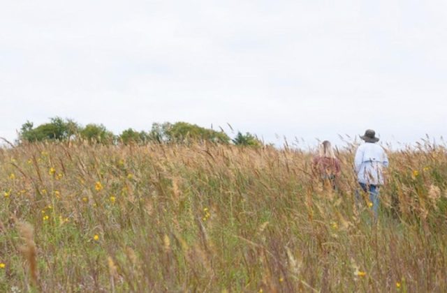
Adams’ SUV lurches through the eroded ruts of the remains of an old ranch road. Maintenance specialist Jimmy Shipp is also on hand. We thread through tunnels of short, spreading post and blackjack oaks so typical of Western Cross Timbers woods, past bright patches of sparse, mid-grass prairie with yellow and purple flowers.
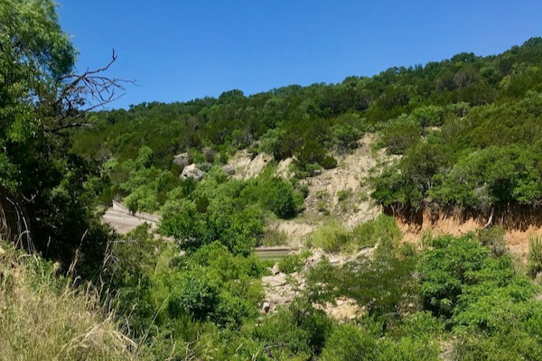
As we reach the crest of the ridge on Tucker Lake’s west side and continue, Adams notes the future locations of developed campsites and support buildings like a bathroom/shower building. Each campsite will feature a large parking space suitable for an RV, water, electricity, picnic table, fire ring, lantern hook and tent pad.
Across the road, a large open-air pavilion and picnic shelters will enjoy panoramic views of the Palo Pinto Creek valley. A nearby children’s playscape will feature natural materials such as logs and boulders. It sounds like a spectacular ridge top campground complex.
“This is my favorite spot,” announces Adams as we pull into a slot in the trees overlooking the lake.
Low horizontal oak branches create an intimate, sheltered feel. Boulders decorated with lichen adorn the shady spot. The view of the lake and wild east side beyond is gorgeous. A delightful breeze brings relief to this warm summer day. I can easily imagine camping here.
Further down the ridge road will be tent camping with pad sites, tables, fire rings and nearby potable water. The walk-in style features centralized parking within 100 yards, making the campsites ultra-quiet and natural. The western hiking trails will originate here.
Below the ridge at the Tucker Lake dam base, a shaded equestrian campground will include the same amenities as the main campground, plus double corrals. The park will have about 60 campsites in all.
ROOM TO RAMBLE
At nearly 5,000 acres, Palo Pinto Mountains State Park has a lot of room to roam. The eastern half possesses a striking C-shaped ridge with two of the park’s tallest peaks forming a broad flat valley. On the other side lies a deep, yawning ravine. The eastern trails here, accessible from the visitor center, promise to be exceptionally remote, some heading to striking scenic overlooks where you can see for miles.
“There are some 60 prehistoric sites and 80 or so historic sites. The oldest prehistoric artifacts we’ve found was a Paleo-Indian point between 8,000 and 16,000 years old. A place rich in natural resources and cultural history,” says Adams.
The park’s half west of Tucker Lake is home to two significant peaks and follows Palo Pinto Creek as it meanders near the northern park border for nearly five miles, heading toward the Brazos River. A few pools along its winding path are perfect for swimming or fishing. It is reptile and amphibian nirvana. A long western extension soars up to another 1,400-feet plus peak.
“It’s hard to say what we’ll end up with. We’re looking at 18 to 20 miles to start out,” says Adams. “Where we’ll end up, who knows? There’s a lot room out here.”
Texas Parks and Wildlife experts are eager to apply their trail knowledge to transform a network of ranch roads, notorious for being straight and erosion-prone, into the winding trails hikers prefer.
Hikers will have company on the trails. The terrain is home to wild turkey in the riparian corridors and plentiful white-tailed deer. Mountain lions and wild hogs occasionally pass through. Woodland creatures include raccoon, opossum and squirrel, while eastern cottontail, nine-banded armadillo and gray fox favor the fields. Also present: broad-banded copperhead and western diamondback rattlesnake. Wear boots.
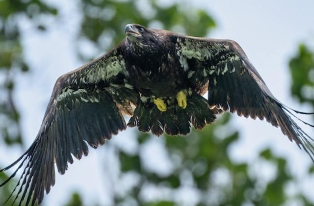
The park is notable for its birds, including the rarely seen golden-cheeked warblers and black-capped vireos. You might see the yellow flash of an American goldfinch or a spotted towhee’s bold red chest. In the crepuscular hours, barn swallows will lace the sky. Visitors to Tucker Lake should stay alert for the great egret’s flamboyant white wings and listen for the dashing royal-blue kingfisher’s raucous call.
But you might find more venerable company as well.
“There are some 60 prehistoric sites and 80 or so historic sites. The oldest prehistoric artifacts we’ve found was a Paleo-Indian point between 8,000 and 16,000 years old. A place rich in natural resources and cultural history,” says Adams.
Explorers should know to leave all historical items in place.

LIMITED PARK ACCESS AVAILABLE
While it will be a year or more before Palo Pinto Mountains State Park is fully operational, a shady picnic area at the terminus of FM 2372 is open. From there, a trail leads along the dam. The north, east and south lakeshores are open to exploration.
Tucker Lake is the municipal water source for Strawn and remains open to the public for fishing or floating. While small non-motorized boats are allowed, there is currently no boat ramp. The road that goes to the lake from the highway is also open to the public.
Access to the lake will change, moving to the west side below the campgrounds where there will be a small day-use complex. It will include a large fishing area, long pier and boat ramp. Once the park is open, only boats with electric motors will be permitted to ensure lake tranquility.
As COVID-19 allows, star parties from the astronomical societies of Dallas and Fort Worth occur a couple of times a year. Texas Equestrian Trail Riders Association and the North Texas Range Riders occasionally sponsor trail rides. Keep an eye on the park’s Facebook page for news of the first-day hikes and closures.
“Once we start construction, we won’t be able to have it open to the public,” cautions Adams.
Palo Pinto Mountains State Park
About: 4,800 acres of former ranch land, 75 miles west of Fort Worth, is being developed as a State Park. Nearby city is Strawn.
Opening: Currently, a picnic area at the terminus of FM 2372 is open. From there, a trail leads along the dam. The north, east and south lakeshores are open to exploration. However, the park will close when construction begins, which is expected to start later this year. Planned opening is 2023.
RELATED ARTICLES
If passed, Prop 5 would boost funds to state parks
Dallas attorney updates popular Texas camping guide
Rockwall author offers witty hiking guide
Stay up to date on everything green in North Texas, including the latest news and events! Sign up for the weekly Green Source DFW Newsletter! Follow us on Facebook and Twitter. Also check out our new podcast The Texas Green Report, available on your favorite podcast app.
